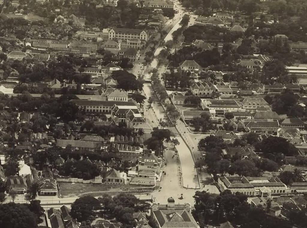
One of the first aerial photographs of Jakarta, taken on 24 November 1924, moments before the first plane ever touched down in Indonesia. Jan Thomassen à Thuessink van der Hoop (1893-1969) was captain of a Fokker F.VIII which already departed from Amsterdam on 1 October 1924 but took seven weeks to arrive in Batavia, after having experienced several technical issues. Here the plane flew over the area of Hotel des Indes and Postspaarbank (Bank Tabungan Negara) and we are looking eastwards across Noordwijk (Jalan Juanda) on the left of the canal and Rijswijk (Jalan Veteran) on the right side.
Harmonie
On the right front of the photo society De Harmonie. Halfway the photo on the right side we recognise Paleis Rijswijk (now Istana Negara), further up the right Hotel de Nederlanden. Along Noordwijk on the left side of the canal many offices of which those of the ENLVM, NILLMIJ and NHM were the most well-known. On the front left, on the corner of Molenvliet Oost (Jalan Hayam Wuruk) and Noordwijk an empty site where a few years later the construction of Hotel des Galeries would commence.
This road between Jalan Thamrin and Pasar Tanah Abang in Jakarta is officially part of the subdistrict Tanah Abang and has had many names over the years. Around 1800 it was called “Weg van Weltevreede naar Tanna Abang” (road from Weltevreden to Tanah Abang). It basically was the road that Justinus Vinck had built in 1735 to connect the newly constructed pasars of Tanah Abang and Senen. During the second half of the 19th century the name “Kampoeng Lima” started to appear on maps, a name that has existed until the construction of New Gondangdia during the 1910s. As soon as the Nieuwe Tamarindelaan (now Jalan Dr Sam Ratulangi, or Jalan Asam Baru) was opened, the Kampoeng Lima road was renamed into Oude Tamarindelaan (Old Tamarind road).
Jalan Asam Lama
Even after independence it was still known as Jalan Asam Lama (the Indonesian translation of Old Tamarind) until the second half of the 1950s when it was renamed into Djalan KH Wahid Hasjim (in 1972 after the spelling change it became Jalan KH Wahid Hasyim), named after the minister of religious affairs in a couple of Soekarno’s cabinets. He died tragically in a car accident in 1953, only 38 years old. His son Abdurrahman Wahid (or Gus Dur) became the later President of Indonesia. The street name Jalan KH Hasyim Ashari (formerly Gang Chaulan) is named after the father of KH Wahid Hasyim.
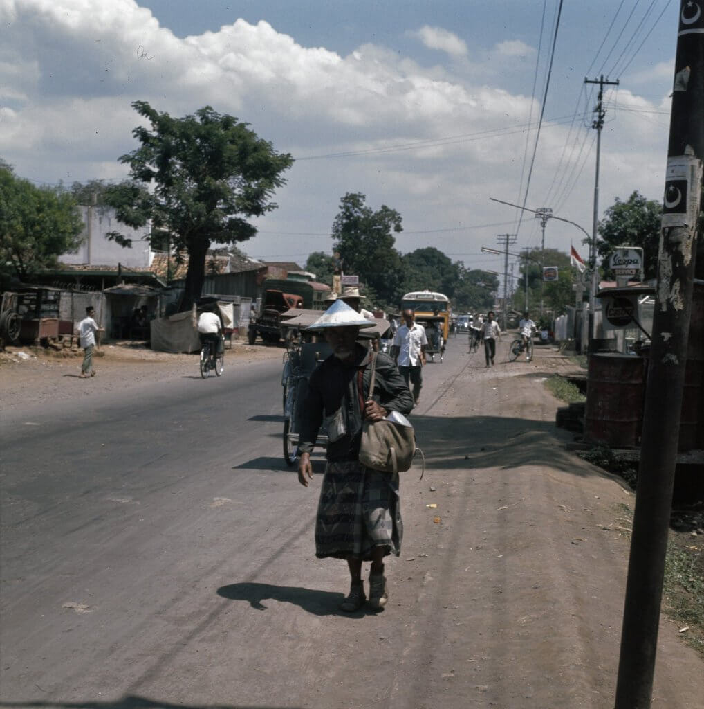
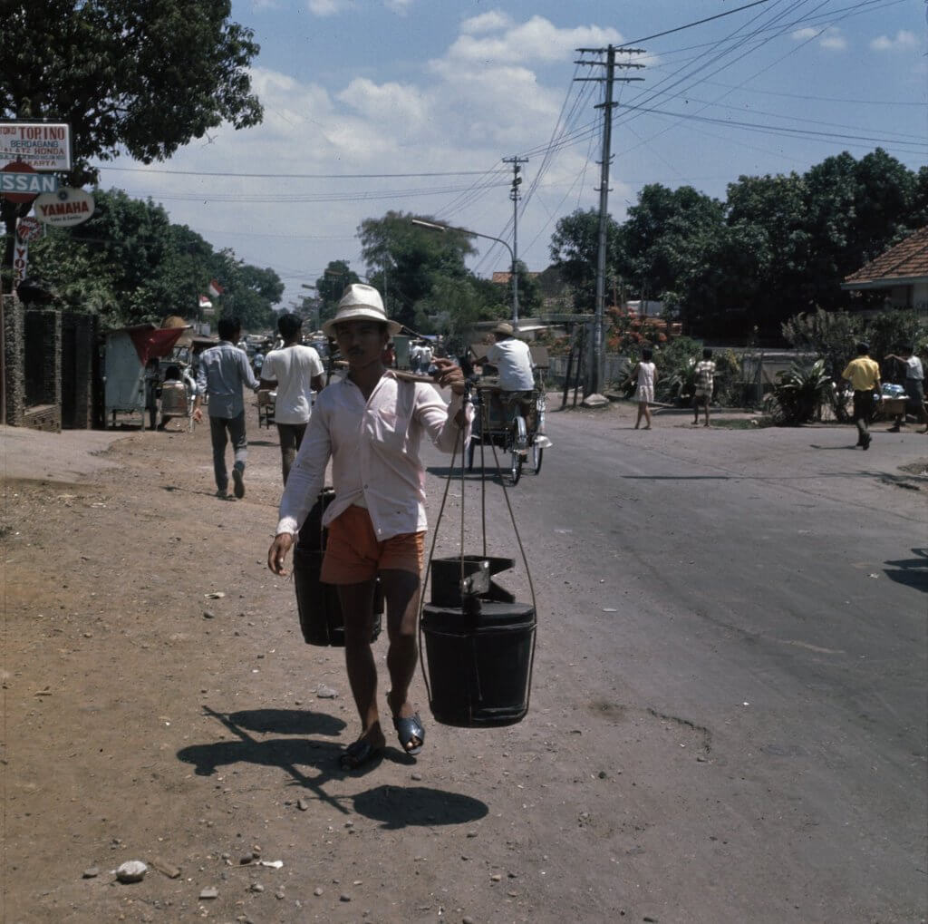
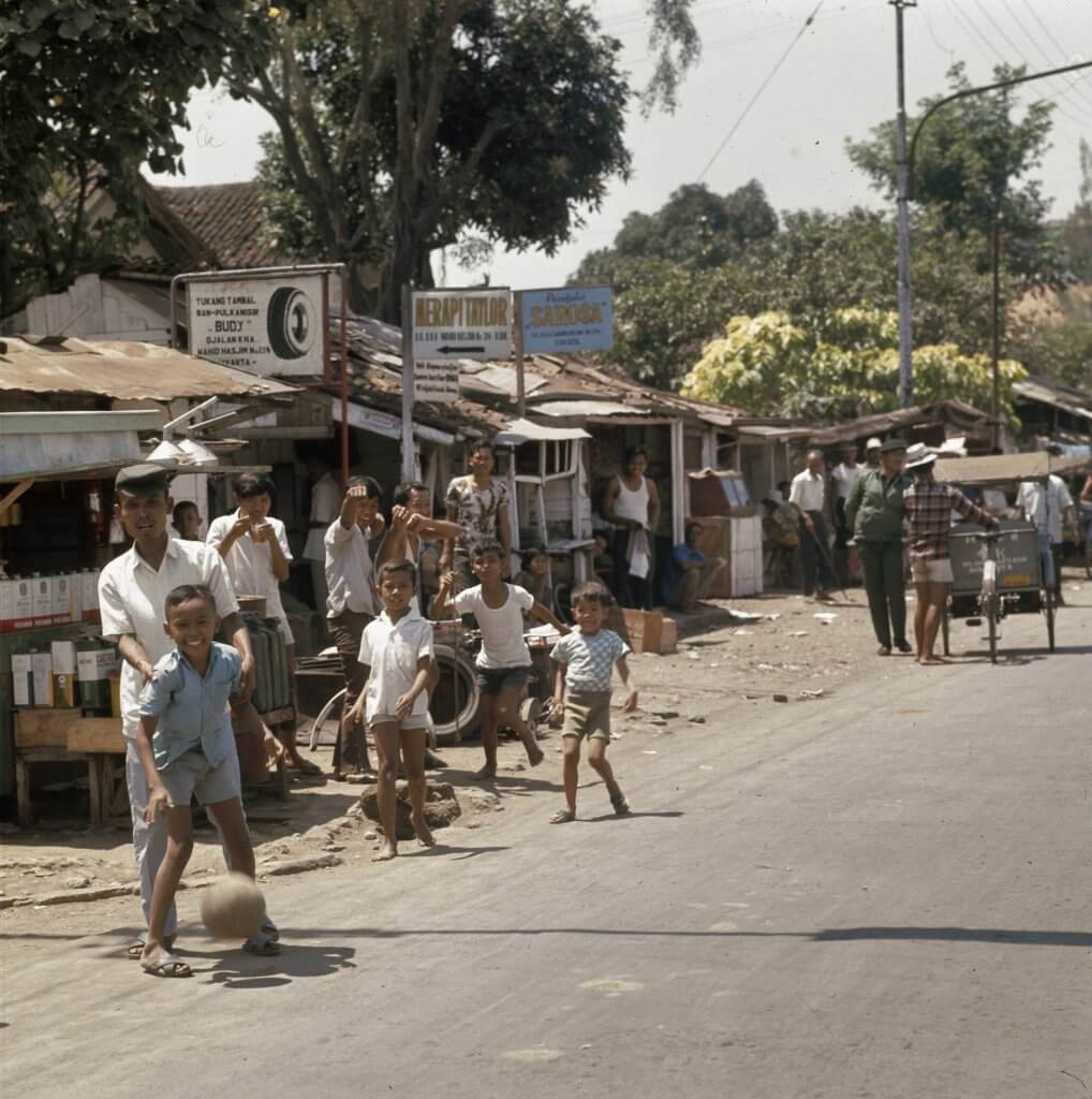
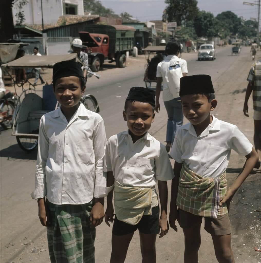
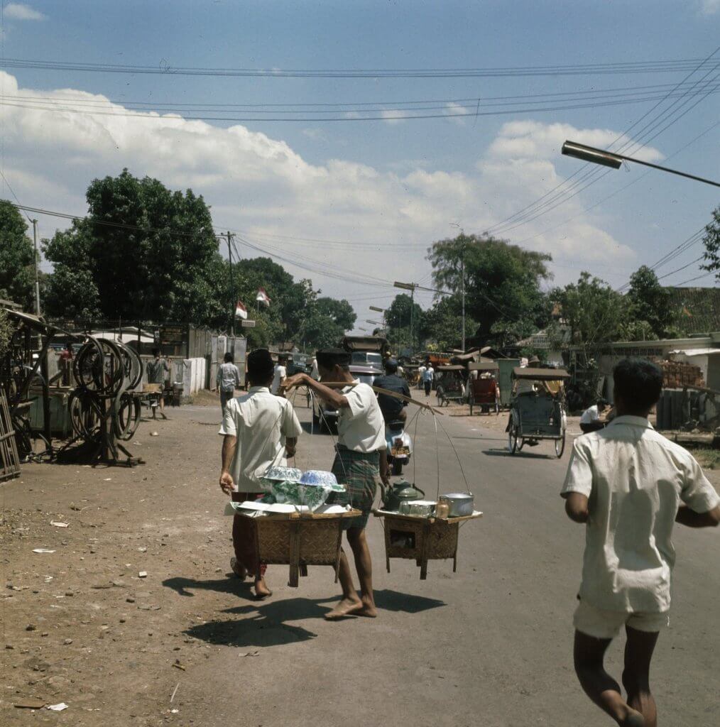
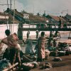
Queen Juliana state visit
It was Dutch photographer Joost Evers (of ANEFO) who -in Jakarta during the state visit of Queen Juliana in August 1971- left his hotel during a break, walked from Jalan Thamrin to Pasar Tanah Abang and took dozens of beautiful and razorsharp colour photos. These lovely pictures show peaceful scenes of a street that apparently looks like it could have been in a small town in Central Java. A striking contrast with the four lane noisy Jalan KH Wahid Hasyim of today. When staying in Hotel Kosenda on this street last year I got told by an old Jakarta man that this street is still known by its nickname Jalan Asam Lama.
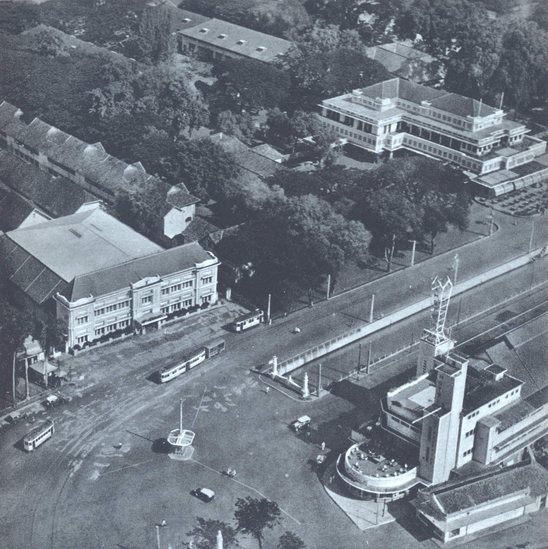
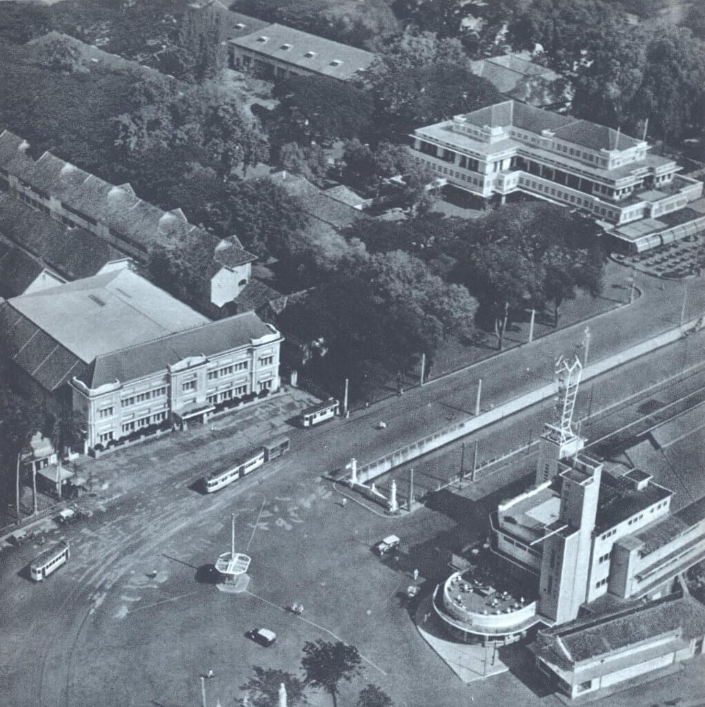
A rare aerial view of the plain in front of society De Harmonie, taken by a KNILM airplane in 1935. De Harmonie itself is not visible, but a few other historic Jakarta icons of the past are. On the top and top right the complex and main building of Hotel des Indes, which was demolished in 1971. Under and behind the trees left of the main hotel building lies the 19th century dependance of the hotel, which had been in use as a reception pavilion. At the back we see various guest buildings and other pavilions. On the front right Hotel des Galeries where we notice deck chairs on the first floor’s terrace. This building does still partly exist today but has sadly been unrecognisably altered.
Postspaarbank – Bank Tabungan Negara
On the left the head office of the Postspaarbank (now Bank Tabungan Negara), which does still exist today and even has the name ‘Postspaarbank’, initially removed during the early 1950s, back on top of the building since 2018. Besides some tram carriages and the odd car, it is very quiet at this important intersection of the city, probably -as we can conclude from the tree shades- as this picture has been taken in the early hours of the morning.
Archives destroyed
The archives of the KNILM comprised of thousands of unique aerial photos from all over the archipelago, taken from 1924 onwards. They were stored at the premises of the Topographische Dienst but sadly all destroyed by the Japanese during World War II. The only KNILM photos that exist today are the ones which were sent to archives and museums in the Netherlands before 1940, and ones like these who were published in books. This photo appears in the book Gordel van Smaragd by Dirk de Vries.
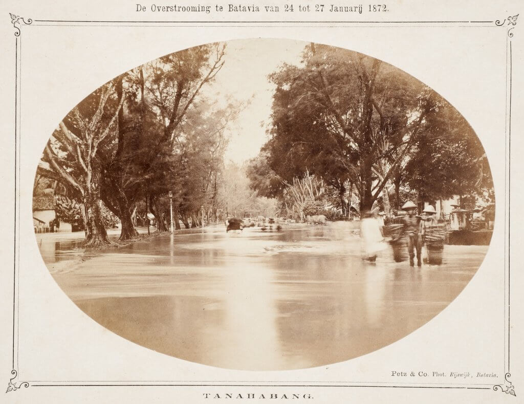
Floods on Tanah Abang West (Jalan Abdul Muis), 1872
The floods of 1872 were one of the most destructive in Batavia/Jakarta. The Ciliwung River had swollen so much that even opening of the sluice gates proved insufficient. The river followed the original loop and flooded the entire lower part of the city, and in Weltevreden (Jakarta Pusat) the areas around Rijswijk (Jalan Veteran), Noordwijk (Jalan Juanda) and Molenvliet (Jalan Gajah Mada, Jalan Hayam Wuruk) were affected. Even Tanah Abang was not spared. The northern section of Tanah Abang West (Jalan Abdul Muis) was entirely flooded, including the Petodjo (Petojo) kampung and the Tanah Abang cemetery (Taman Prasasti).
Thick layer of mud
When the water had subsided most of Tanah Abang was covered in a thick layer of mud. This is a dramatic picture of the banjir (flood) in Jakarta, from 148 years ago. The photo with the title “The flood in Batavia from 24 to 27 January 1872” has been taken on the road Tanah Abang West (Jalan Abdul Muis), looking south, just before the turnoff to Kerkhoflaan (Jalan Tanah Abang 1). Taman Prasasti is around 200 meters to the right of this picture. The photo was taken by a photographer of the studio of Petz & Co. Floods are still happening in Jakarta these days, and if you’re hit by the current 2020 floods, please take care and make sure you are safe!
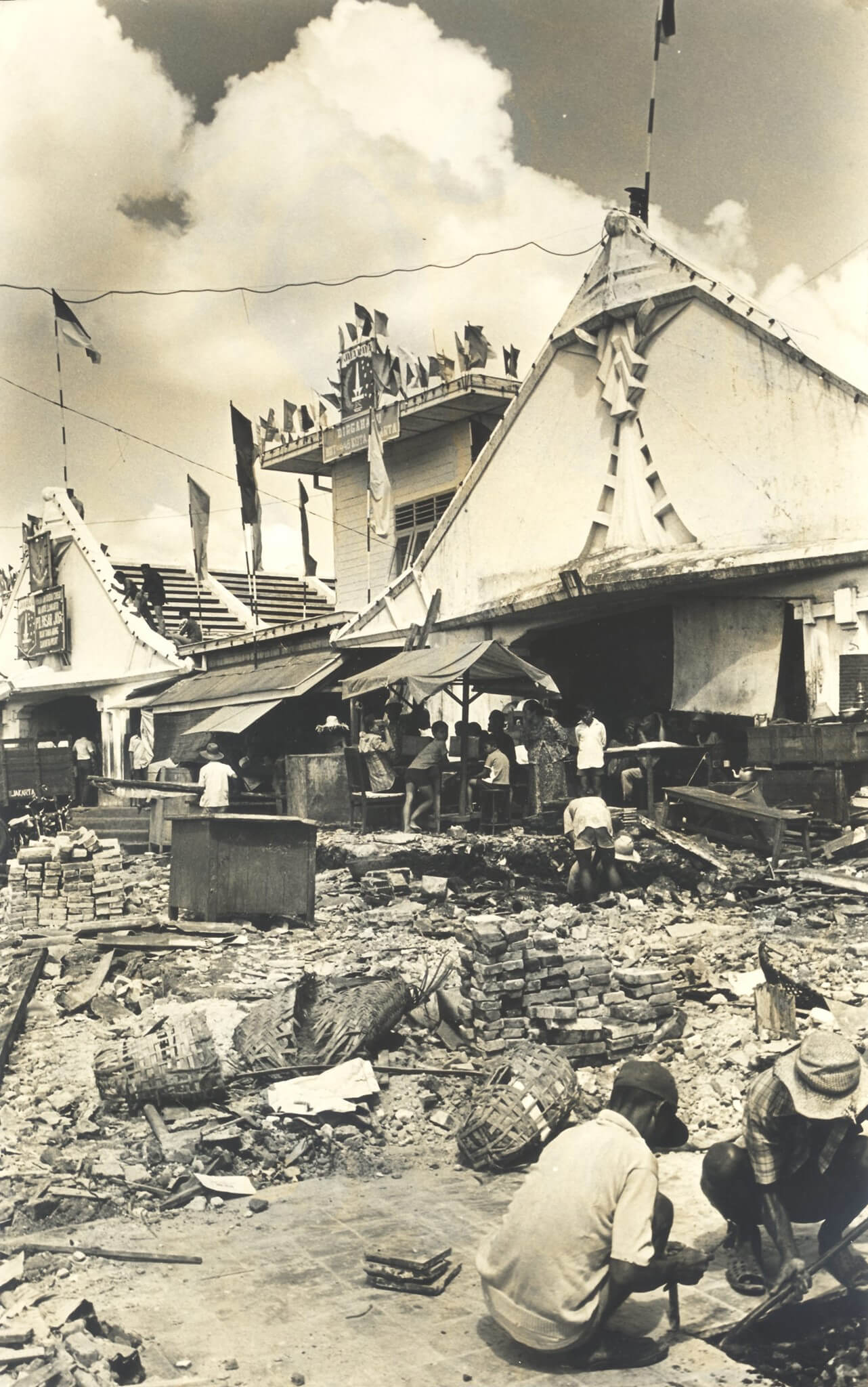
Demolition of the 1927 market building in Tanah Abang, 1973
By the early 1970s the largest textile market of Indonesia was still housed in a single storey building that dated back to 1927. The market was too small and many sellers used the surrounding streets to set up their textile stalls. There was usually non-stop traffic chaos around Pasar Tanah Abang during the day. In 1973 Jakarta’s Governor Ali Sadikin (1927-2008) gave the green light to demolish the old pasar and to build a new four storey concrete market complex with a parking deck on the roof.
Nightmare for market traders
The two years between the demolition and the re-opening of the new pasar were a real nightmare for the market traders. As there was no alternative space, the city council had approved that textile sellers could set up their kiosks in the surrounding streets, with the result that Jalan Wahid Hasyim and Jalan Fachrudin were two open air markets for nearly two years. When the new Pasar Tanah Abang opened in 1975 it had room for more than 4,300 kiosks.
Multiple fires
The new Tanah Abang market complex suffered from serious fires on several occasions. One block of the pasar complex burnt down on 30 December 1978, a second block went up in flames on 13 August 1979. In both cases the sections were able to be rebuilt, but a destructive fire in 2003 meant the end of the four-storey market building. Between 2005 and 2010 the two new 18-floors Blok A and Blok B were constructed, and Pasar Tanah Abang is now the largest textile market in southeast Asia. On this photo from 1973, taken by Kartono Ryadi for Kompas, the demolition of the 1927 pasar has commenced.
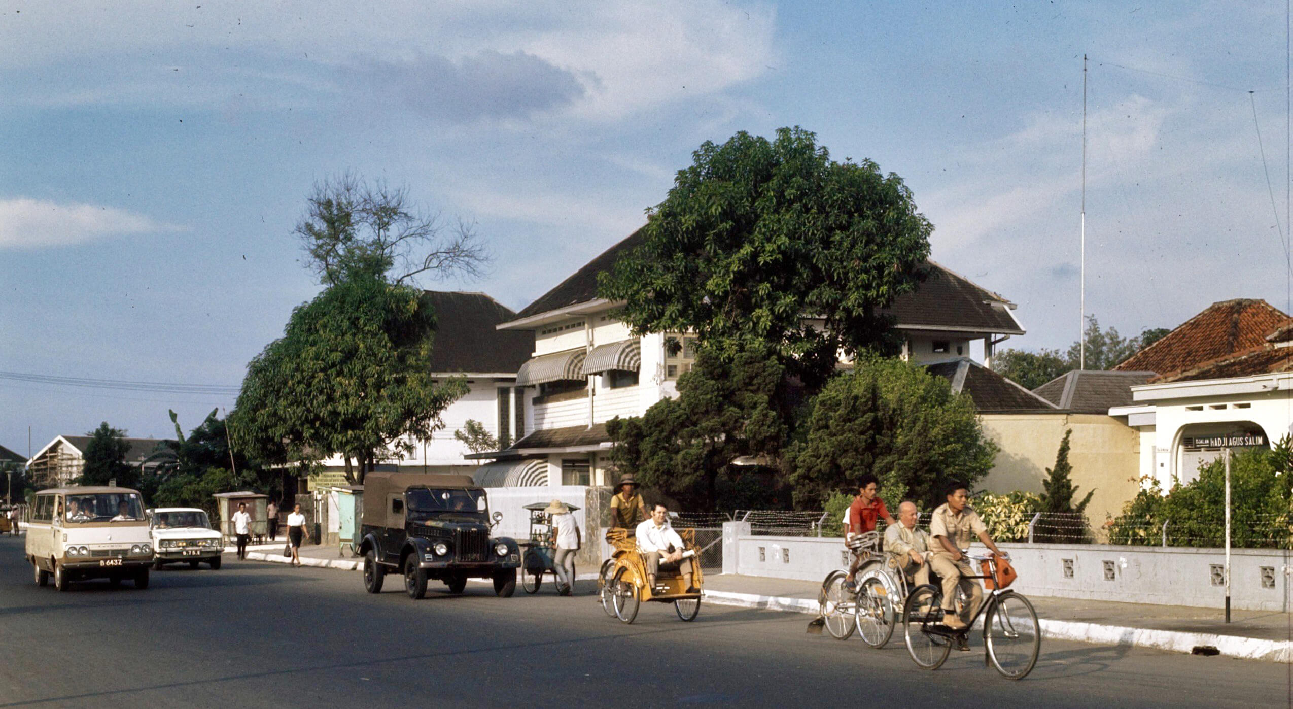
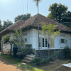
Jalan Haji Agus Salim, now Jalan Pamekasan, in 1971
A suburban scene on Jalan Haji Agus Salim nearly half a century ago. The photo has been taken on the most southern end of the road which is now known as Jalan Pamekasan (between Jalan Imam Bonjol and the intersection of Jalan Sumenep with Jalan Sudirman). We are looking north towards Jalan Imam Bonjol, which is not visible on this photo. The single level house on the right stands on the corner with Jalan Sumenep and still stands today although it is empty and in poor condition. In between the two double storey houses is the turnoff to Jalan Kusuma Atmaja (formerly Jalan Tosari).
Jalan Pamekasan
On 1971 maps this street is already mentioned as Djalan Pamekasan, although the street sign on this photo still says Djalan Haji Agus Salim. The northern end of this street, between Medan Merdeka and Gereja Theresia was known as Laan Holle until July 1950 when it changed into Jalan Sabang although today it is still often referred to as Jalan Sabang and taxi drivers in Jakarta have no problem locating it when you mention this previous street name.
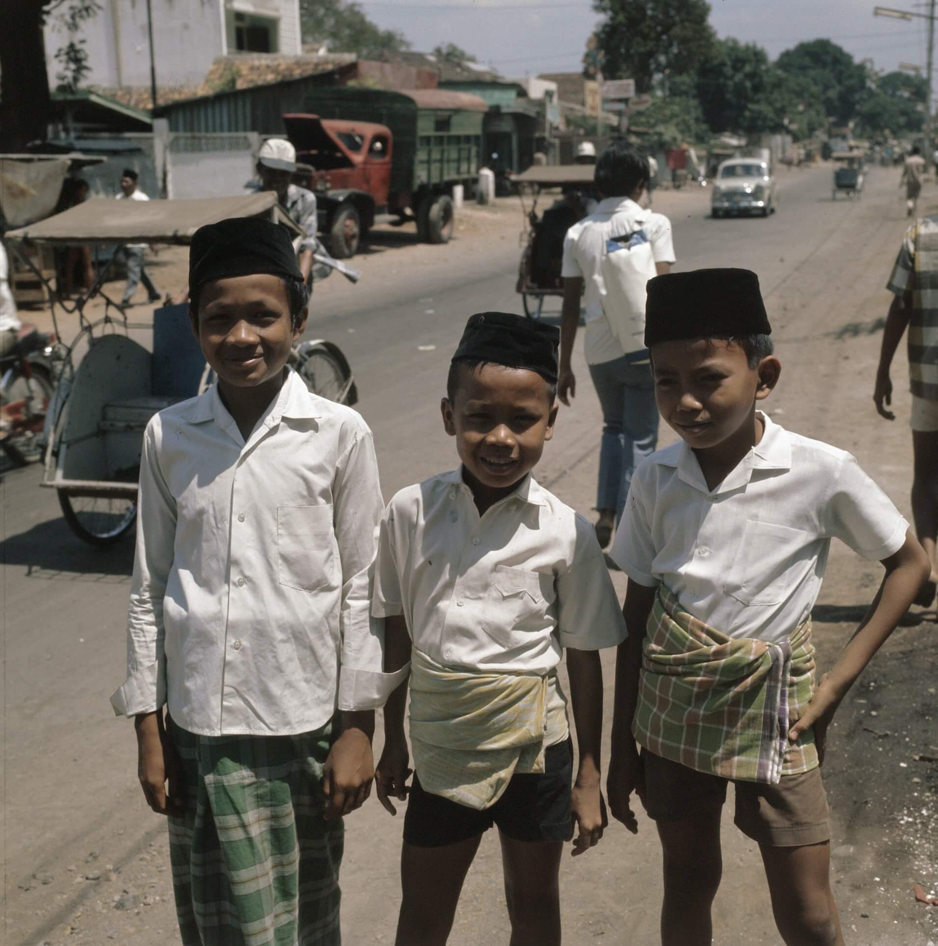
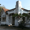
Becaks
By 1960 the road had been renamed into Jalan Haji Agus Salim, after the Indonesian journalist, diplomat and statesman Agus Salim (1884-1954), even south of Gereja Theresia which was previously known as Jalan Gereja Theresia (or: Theresiakerkweg in colonial days). What today is known as Jalan Gereja Theresia was previously named Jalan Sunda (or Soendaweg). On this photo we see a few becaks, which was still a common mean of transport in Jakarta in 1971.